In the context of modern urbanism, spatial analyses have become critical tools for understanding and planning the dynamics of cities. They offer scientific insights into how flows of people move within urban spaces, and can, among other things, identify strategic locations for future urban developments. To better illustrate their potential, based on public information, a series of street network analyses have been developed for Baia Mare, the author’s hometown.
What information can the street network convey at a first glance?

Mapping the street network within the geographical and topographical context of a city can provide, at a first glance, unique information about potential development patterns. For example, in the case of Baia Mare, after a simple visualization of the street grid (Img. 1), the following conclusions can be drawn:
– From the perspective of connectivity across the entire local administrative unit (LAU), the southern part (the city part) enjoys a much higher degree of connectivity compared to the northern area (Firiza, Blidari, etc.). The dense network in the south indicates a well-thought-out development that facilitates easy movement within the city. In contrast, the fragmented network in the north indicates the presence of isolated neighborhoods with limited access to the city. Naturally, these aspects are closely related to the geography of the LAU.
– For the most part, the structure of the street network is a grid (orthogonal network) that facilitates accessibility and uniform distribution of resources. However, there are some areas with a radial structure, where the main roads converge to a central point. One such example is the area around the Food Market near the Old Town, where the central point is the roundabout near the market. In theory, such a pattern indicates a concentration of services and activities at that central point, which automatically leads to congestion issues. These problems become evident in this area during peak traffic hours.
– In general, the density of the street network is uniform in the southern part of the LAU (the city area), indicating a balanced development in which the central areas are well-integrated. At the same time, there are peripheral areas with a lower street grid density, such as the northern part of the city – Valea Borcutului, Valea Roșie, Viilor Street, the Ferneziu area, etc., where this low density is due to the terrain. Another example highlights the southern part of the city, behind the Railway Station and the Craica Area, where the main cause of low density, proportional to development, is the railway line, which acts as a barrier. The industrial area near the Penitentiary also has a low density due to its industrial function. However, areas with low street network density can be seen as having potential from the perspective of commercial services.
Complex Analyses on the Street Network
Mapping the street network is only the first step toward a broader understanding of movement flows and potential development patterns. Complex and computationally intensive spatial analyses on the street grid can provide insights and perspectives invisible to the naked eye. Such a set of methods and spatial analyses was developed by Bill Hillier and others around 1984 and has been refined over time by university professors and major architecture firms worldwide. These analyses can visually describe the logic of how a society functions, or more precisely, they visually show the connection between how certain spaces or urban systems are configured and how people perceive, move, and use these spaces or systems.
In the case of Baia Mare, three complex spatial analyses were conducted on the street grid, specifically Spatial Integration, Spatial Choice, and Streets with Development Potential (HILC – high spatial integration and low spatial choice). These analyses visualize the street network as a graph and do not take into account the direction of traffic, speed limits, street width, quality of asphalt, or whether the streets are uphill or downhill, etc. These are specialized analyses focused solely on the urban network but highlight the hidden dynamics of the network.
Spatial Integration – Baia Mare’s 2024 Street Network – a spatial perspective analysis
The Spatial Integration Index refers to how well-connected each street segment is to all other street segments within the same network. In theory, this index shows how complex the process is to reach a particular street segment from all other street segments. The more accessible a street segment is (high spatial integration), the more popular it becomes within the network. This analysis can “predict” the degree of pedestrian use of a street in the network, making it an index with a forward-looking perspective.

For example, in the Spatial Integration analysis of the entire network (Img. 2), it can be observed that the majority of streets in the city center are well integrated, making them popular for pedestrian traffic. Since they are popular for pedestrian traffic, it is recommended that these streets encourage walking and thus benefit from updated pedestrian infrastructure such as: sidewalks that are separated from vehicle traffic arteries, public lighting, vegetation (trees) to minimize the impact of urban heat islands, urban furniture (benches) for resting, etc. For the most part, the streets with high spatial integration in Baia Mare have this basic infrastructure. Placing bike lanes on the sidewalks is not encouraged, as this could disrupt the flow of pedestrian traffic. Streets in the northern part (Ferneziu, Firiza area) are not well integrated at the global level, so they are not popular for pedestrian traffic across the entire network.
If the first phase the analysis was conducted at the level of the entire network, for a more detailed visualization and more accurate data at the neighborhood level, the analysis was carried out on each point of the network within radii of 1200m, 800m, and 400m (GIF/VIDEO.1). These images show, for each street segment, the perceived spatial integration index for 15, 10, or 5-minute walking distances. In other words, for 15, 10, or 5-minute walks, the popularity of the street segments within the network changes compared to the global perspective. GIF/VIDEO.1 can thus be used to highlight and prioritize street segments, intersections, or areas that should benefit from modern pedestrian infrastructure, including illuminated crosswalks, intelligent traffic lights, and video surveillance. Moreover, areas with high spatial integration within 400 meters are encouraged to benefit from mixed activities and cultural diversity, such as commercial spaces, offices, housing, and areas for cultural events, along with a friendly urban design including neighborhood parks with playgrounds and green spaces, as well as public transport stations and bicycle parking areas.
Spatial Choice – Baia Mare’s 2024 Street Network – A Spatial Efficiency Analysis
The Spatial Choice Index shows the likelihood that a specific street segment will be used for “shortest path” trips from any point in the network to any other point in the network. These street segments have a strategic importance for movement flows within an urban network.

The global analysis of the entire street network (Img. 3) highlights the city’s main boulevards as having a high degree of spatial choice. Therefore, planning public transport routes on these arteries is encouraged, for example, through dedicated lanes for public transport. To encourage transit and discourage vehicle parking on these arteries, the use of dynamic pricing for parking (higher prices during peak hours, and lower prices in the evening) is recommended. On these arteries, multimodal transport is also encouraged, with bike lanes separated from both pedestrian and vehicle traffic, along with wide sidewalks to accommodate high pedestrian traffic flows.
Additionally, on streets with high spatial choice, it is recommended to widen traffic lanes, with the observation that doing so will encourage motorized traffic, and in the medium to long term, will lead to more frequent car use in the city until the network reaches maximum capacity. Although it may seem counterintuitive, multimodal transport should be encouraged on these arteries, and vehicle parking discouraged. Road and pedestrian safety thus becomes a priority on these arteries and can be achieved by integrating smart technologies, real-time traffic management systems, air quality monitoring, or intelligent lighting solutions to optimize the performance of these streets.
The Spatial Choice analysis conducted at each point of the network within radii of 1200m, 800m, and 400m (GIF/VIDEO.2) allows for the visualization of areas with the potential to become public plazas in neighborhoods. These areas naturally attract traffic and are thus ideal zones for commercial activities, especially those that require foot traffic. An urban design that allows easy orientation for people unfamiliar with these areas is essential, as are attractive public spaces and amenities. This can be achieved through street signage, wayfinding signs, or visual landmarks, as well as squares, public gardens or parks located near these zones. Additionally, access to economic and social functions can increase the economic attractiveness of these areas throughout the year.
HILC (High Integration and Low Choice) – Baia Mare’s 2024 Street Grid – A Hidden Potential Analysis
Street segments that fall into the HILC category (High Integration and Low Choice) have potential for development, yet this potential often remains untapped. These streets are well connected to the network, making them easily accessible, but they are not main routes preferred for transit, as they are less frequently used for “shortest path” trips. This situation suggests an underutilization of the capacity of these streets, and at the same time, represents an opportunity to revitalize adjacent areas.

For street segments classified as HILC (Img. 4), urban planners can direct urban regeneration strategies and investments toward these areas. These streets have high potential for developments that can enhance the attractiveness of the areas, such as urban revitalization projects, introducing mixed-use functions, and developing pedestrian and cycling infrastructure. Creating appealing public spaces and stimulating local economic activities can transform these streets into points of interest for both residents and visitors.
Additionally, HILC streets could be the launch points for sustainable urban mobility initiatives. Since they are not heavily used for vehicular transit, these segments could become ideal for expanding bike lanes, wide sidewalks, green zones, and even pedestrian-only areas or shared spaces, thereby reducing car dependency and fostering a sense of community. Such a transformation could redistribute pedestrian and cycling flows, better balancing the use of urban space and alleviating congestion on the main arteries.
The HILC analysis conducted at each point of the network within radii of 1200m, 800m, and 400m (GIF/VIDEO.3) allows for the identification of segments that can contribute to the creation of micro-urban centers or new areas of interest in peripheral or underdeveloped neighborhoods of Baia Mare. These micro-centers can become hubs of social and economic activity, stimulating the spatial integration of neighborhoods and creating a better distribution of urban infrastructure. These micro-centers can also serve local communities by offering public spaces, parks, and essential services, thus improving the quality of life for residents in the area.
The development of more discreet functions in HILC areas, such as small office spaces, educational centers, creative workshops, or small-scale collective housing, could be a solution for harnessing the potential of these underutilized segments. These functions could generate consistent economic activity without overburdening the area, maintaining a balance between the community’s needs and economic demands. For investors, these zones are attractive due to lower land prices and the potential for value growth, especially in the context of an urban reconfiguration that promotes spatial integration and sustainable mobility.
So, why are spatial analyses important in the end?
In conclusion, spatial analyses offer a unique perspective on urban dynamics, helping to identify areas with development potential and infrastructure optimization, as demonstrated by the case study in Baia Mare. By evaluating the street network through Spatial Integration, Spatial Choice, and HILC segmentation analyses, it is possible to strategically identify opportunities to improve connectivity, create attractive public spaces, and develop mixed-use functions that support both movement flows and local economic growth. Integrating these data into urban planning can guide investments and urban regeneration in a sustainable and efficient manner, transforming areas with potential into new hubs of social and economic activity, thus supporting balanced development tailored to community needs.
About the author
Ionuț Mărieș is a Senior Urban Development Consultant specializing in urban technology. With a career focused on strategic urban development, he has played key roles in projects covering resilience of critical infrastructure, integrated sustainable transportation systems, urban regeneration, urban-rural linkages, energy efficiency and climate change adaptation and mitigation. His work extends across the European Union, helping local administrations build smarter, more resilient cities. Ionuț is an alumnus of the Aarhus School of Business and Social Sciences, the Ljubljana Faculty of Economics, the Technical University of Cluj-Napoca, and the Institute for Advanced Architecture of Catalonia. Among others, he has co-authored several publications, including “The Romanian City 4.0” and “The Urban Assets of the Romanian Railways” and is the founder of Deep Dive Conversations – podcast dealing with urban development matters.
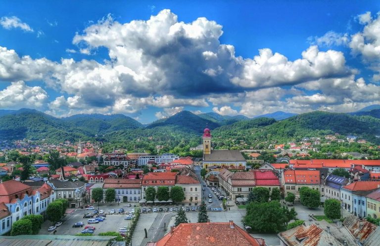
Main photo: Visit Baia Mare


